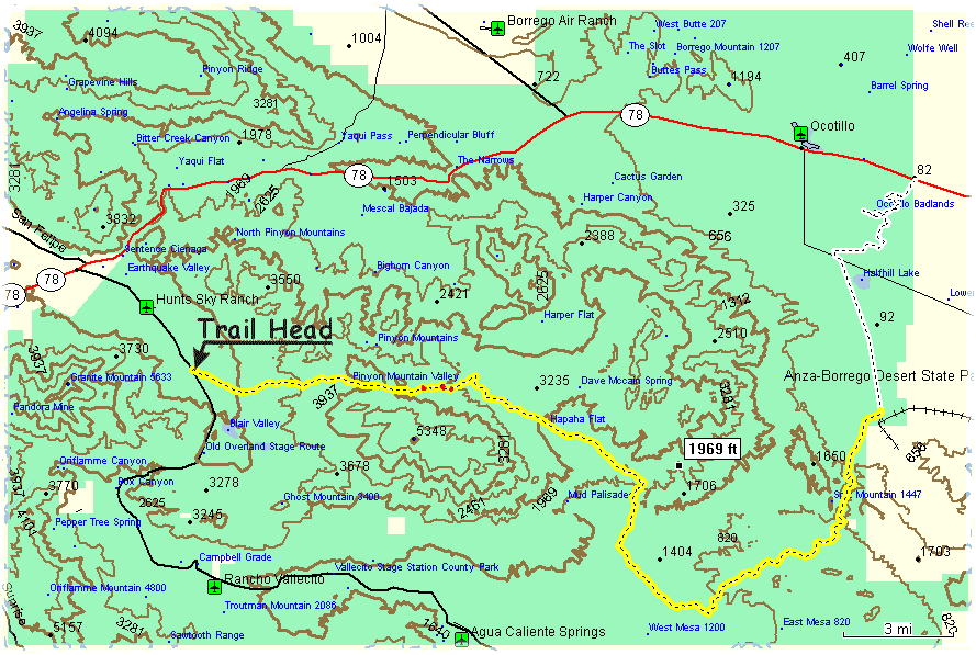
| |
Legend and General Information
|
| Trail
Head |
The coordinates of the trail head are N33.05677
W116.42128
It is on the east side of the S2 (AKA Great Southern Overland St)
four miles South from Scissors Crossing with Highway 78. There is
a gift store 0.3 miles up and across the road from the trail head
, it's parking lot (N33.06042 W116.42467)
is a convenient place to assemble. Daily passes can be bought in
Blair Valley (N33.03777 W116.40961),
1.5 miles down the S2 from the trail head.
|
 |
The yellow with black dashes line represents the main track of
the 03/15/00 Pinyon Mtn Run. The length of this trail is about 30
miles. The coordinates of the trail end are (N33.04068
W116.09649). This is where the Fish Creek Wash meets Split
Mountein Rd.
|
 |
Red dots on the main track represent three major obstacles of the
trail (left to right):
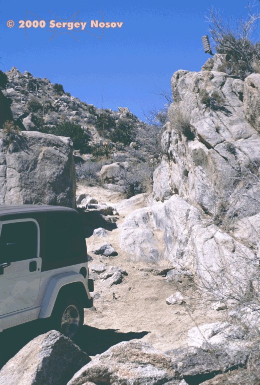
- The
(Jeep) Squeeze. (N33.04952 W116.31187)
- The Hard Top Rock. (N33.05053
W116.30347) This is the obstacle I couldn't pass through
the first time I was on the trail (alone). Do not go four-wheeling
alone, BTW. With Jeff's group, disconnected track bar and help
of spotters, I got through it safely, and my hard top still intact.
If you have a hard top, watch out for the driver side window.
Just as you about to clear the obstacle, your left rear tire goes
in a hole, and if you are not careful, the back of your truck
may swing, hitting the rock at a window level. Watch out, there
are plenty of broken tinted glass already.
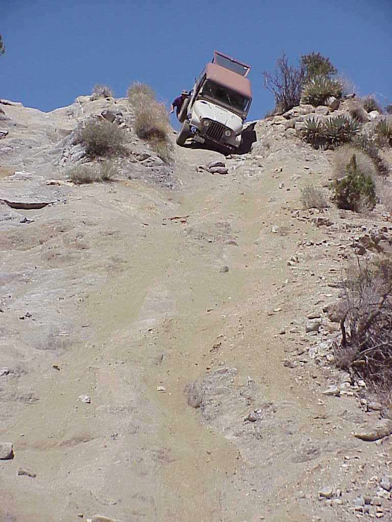
- The
Heart Attack Hill. (N33.04912 W116.30012)
If you are not careful, you can die there. Be as easy on the breaks
as possible. If you are in trouble, do not stop - try to ride
your way through.
|
 |
The white track with black dashes
represent the optional part of the run called "Playing in
the Mud Hills". You can make this adventure as intense as
you wish, or you can skip it all together. I dared to follow some
big boys with my stock TJ and guess what. Once I had to be pushed
when my Jeep high centered. Then, two times I had to be recovered
with a tow strap. On 05/13/00 we started playing in the mud at N33.10526
W116.09735 and finished off-roading to head home at N33.13271
W116.08086. |
| |
|
|